
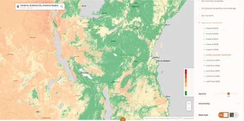
The first field-level soil map for Africa
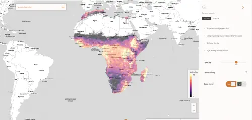
We've built the first field-level soil map for Africa, with 20+ soil properties predicted at 30m resolution for the entire continent.
Our development process applies predictive machine learning technology using data from over 130,000 soil samples, much of it based on years of research by the African Soil Information Service (AfSIS) and other soil data resources.
Built for developers
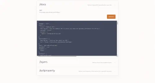
Use iSDAsoil to your advantage. We offer a free API that will allow developers to query our data by location.
100% Free
Regularly updated
Covers all of Africa
Simple API
Rapid updates
We’ve designed iSDAsoil maps for rapid updates and continuous improvement. Do you have African soil data that could be used to improve these maps? Get in touch!
Data Contributors
We are grateful to all partners listed below, who have contributed data to iSDAsoil. We are especially indebted to all partners involved in the AfSIS project. Without this groundbreaking work, iSDAsoil would not have been possible.